Environmental Protection
COASTAL ENVIRONMENTAL CONSERVATION
Starting in the late 1970’s and early 1980’s the Byron Bay community began actively pushing for the establishment of nature reserves, national parks and marine parks to protect areas of coastal environmental significance. The town’s agricultural and extractive industry activities had impacted significantly on the native plants and animals as well as the landforms and view-scapes. Now more than 50% of the combined land and sea area stretching five kilometres either side of high tide between Brunswick Heads north of Byron Bay town and Lennox Head south of the town is incorporated in parks and reserves.
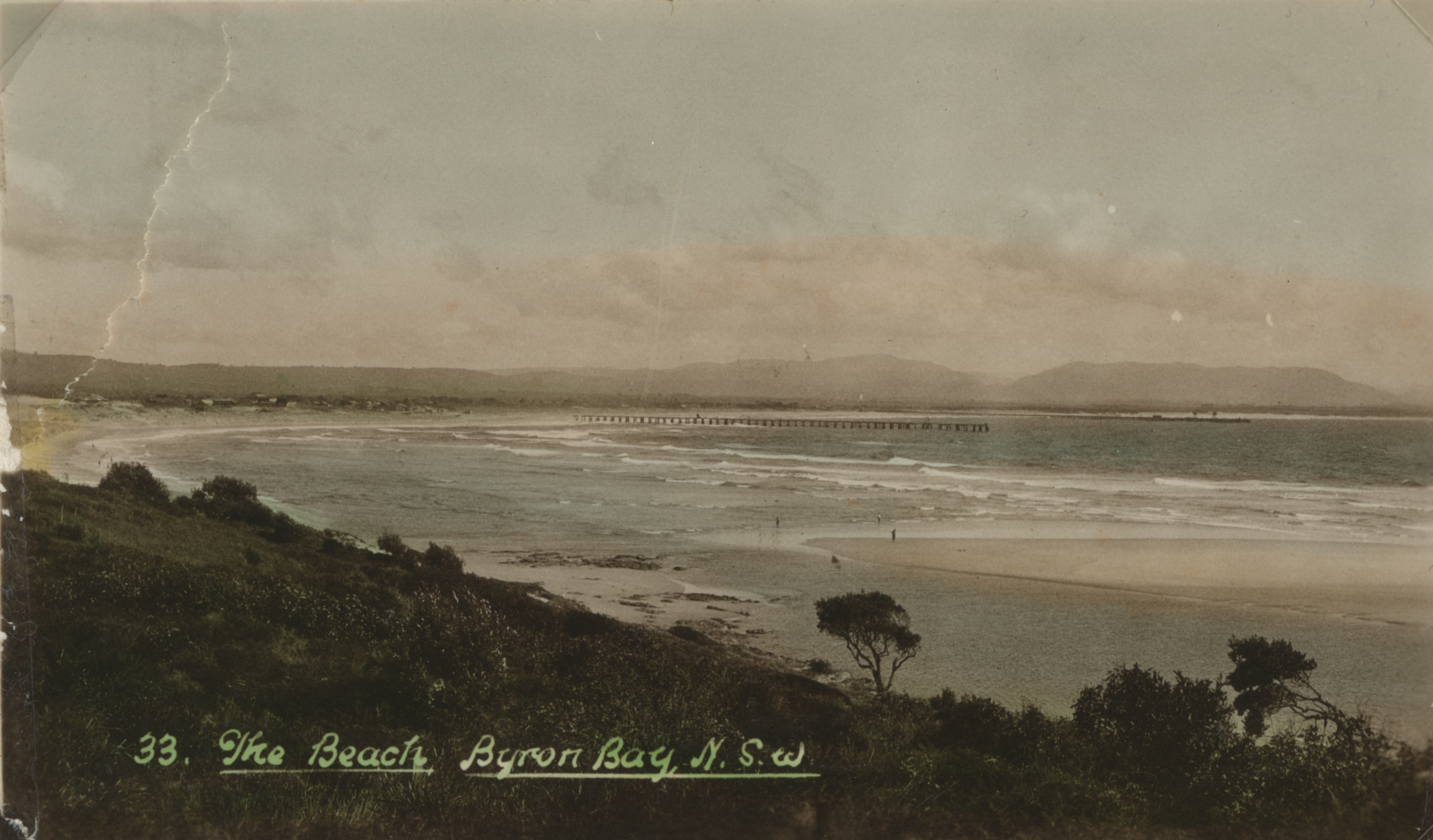
View of the bay, beach and jetty EJ Wright RTRL
The largest and most recent area to be protected is incorporated in the 22,000 hectare Cape Byron Marine Park which was established in November 2002. It extends for three nautical miles (5.55km) from mean high water level and includes the sea bed. It is divided into four zones: habitat protection, sanctuary, general use and special purpose zones. Recreational and some commercial fishing are allowed in the park.
The Park includes exposed and sheltered sandy beaches, rocky shores, rocky reefs, submerged pinnacles, small rocky islands, coral communities, riverine estuaries, coastal creeks and lakes, and sandy seabed habitats. The Julian Rocks Nature Reserve, established in 1982 and popular with divers and snorkelers, is included in the park.
It provides home for dolphins, fish, seabirds, marine plants and threatened species such as little terns, grey nurse sharks and sea turtles. Humpback whales come close to shore in the park on their annual migrations where they can be viewed and monitored.
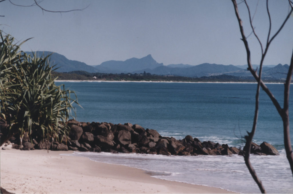
The view to Mt Warning across the broad sandy Byron Bay. EJW Photo – RTRL
Julian Rocks, Cocked Hat Rocks, Cape Byron and beaches around Broken Head, sites of cultural significance to Indigenous people, are included in the park.
There are five Nature Reserves in the Byron area (Marshalls Creek, Brunswick Heads, Tyagarah, Cumbebin Swamp, and Broken Head) covering 1310 hectares and incorporating a wide diversity of habitats ranging from coastal sub-tropical forest, wetlands, salt marsh, dunes, coastal heath and swamps to riverine environments.
Arakwal National Park (297 hectares) was proclaimed in 2001 in a landmark agreement between the local Arakwal Aboriginal people and the NSW government. It was increased to 371 hectares in 2006.
The Cape Byron State Conservation Area of about 98 hectares represents the remnants of the Cape Byron Headlands Reserve which was created in December 1885 to protect native flora and for recreation purposes from the development of the new town of Cavanbah (now Byron Bay). That original reserve incorporated all of the land north east of a straight line running across the neck of the Cape from Tallow Beach to the eastern end of Clarks Beach.
This 1885 initiative setting aside an area for protection of native flora as well as for recreation was one of the first in the NSW. It provided a good model for the strong initiatives of coastal environmental protection and enjoyment which commenced 100 years later and resulted in the reserves and parks in the Byron coastal area today. Residents and visitors are encouraged to explore, enjoy and protect these.
For a detailed map showing the location, zoning and use of these coastal reserves and parks go to: www.mpa.nsw.gov.au/pdf/CBMP-user-guide-map.pdf.