First Europeans
CAPTAIN COOK’S NAMING OF CAPE BYRON:
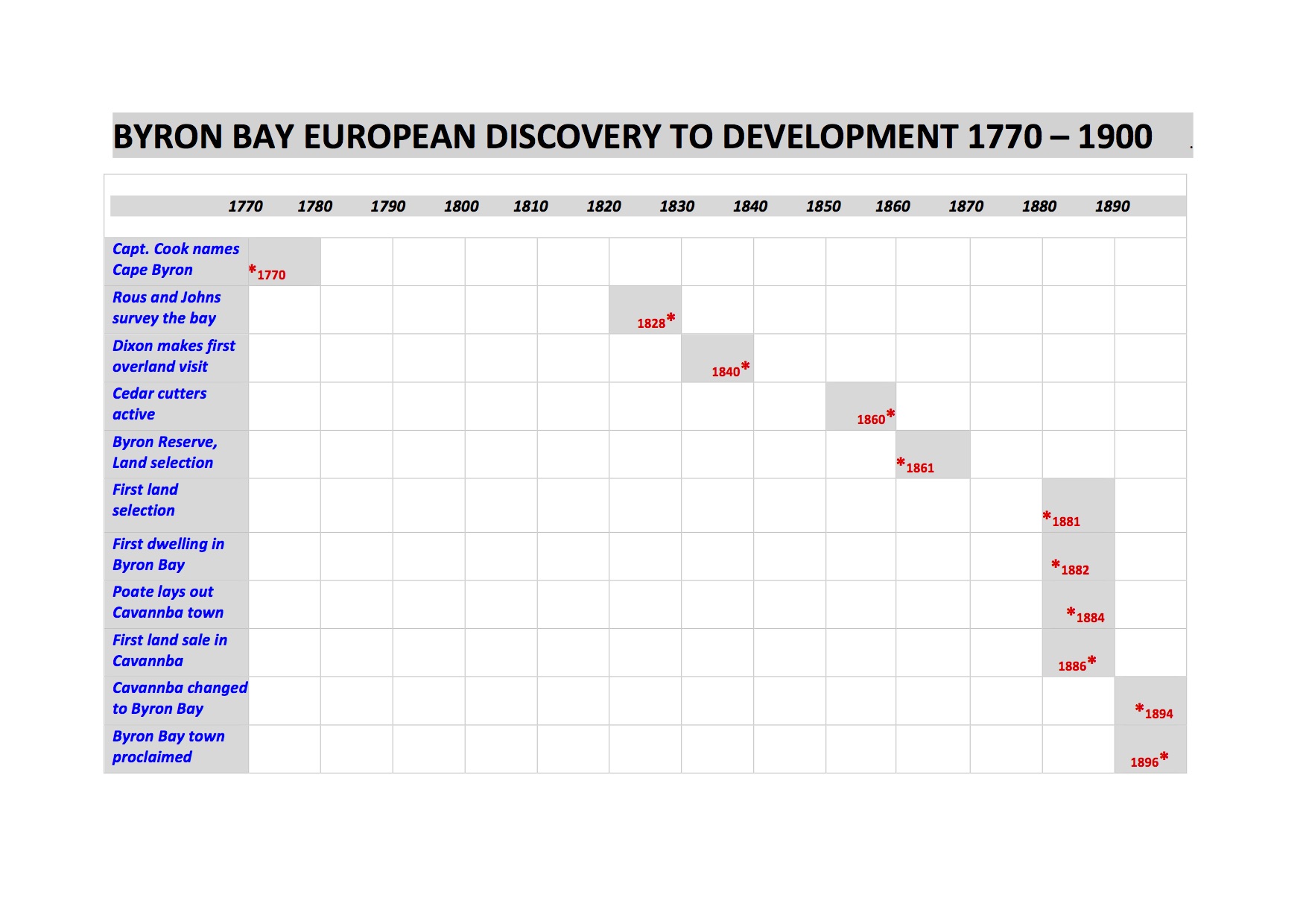
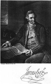
On 15 May 1770, Captain James Cook sailing up the east coast of Australia in the Endeavour passed the eastern most point of the Australian mainland (Walgun in the local Arakwal language). He named it Cape Byron after Vice Admiral (then Captain) John Byron who sailed around the world in HMS Dolphin in 1764-1766.
Cook’s log for 15 May reads:
“….As soon as it was daylight we made all of the sail we could …. At 9, being about a league (5.6km) from the land we saw upon it people and smoke in several places. At noon we were by observation in latitude 28o 39’S and longitude 206o 27’W.
A tolerable high point of land bore northwest by west a distance 3 miles; this point I have named Cape Byron. It may be known by a remarkable sharped peaked mountain lying inland northwest by west from it. From this point the land trends north 13 west. Inland it is pretty high and hilly but near shore it is low; to the southward of the point the land is low and tolerable level….”
(He was 5.6km off Cape Byron and Tallow Beach).
Joseph Banks, botanist on Endeavour, also records sighting Aboriginal people in his journal on 15 May “…we observed them with glasses for near an hour during which time they walked upon the beach and then up a path over a gently sloping hill, behind which we lost sight of them. Not one was observed to stop and look toward the ship: they pursued their way in all appearance unmoved by the neighbourhood of so remarkable an object as a ship…”
Sailing north Cook sighted the peak Wollumbin, which he named Mt Warning. His journal of Wednesday 16 May records “….we now saw the breakers again within us which we passed at the distance of one league, they lay in the latitude 28O 08’ S and stretch off east two leagues; …….. their situation may always be found by the peaked mountain before mentioned which bears southwest by west from them, and on their account I have named Mt Warning….”
But the Endeavour’s crew did not land in Arakwal or Bundjalung country. Cook sailed on northward claiming all of the east coast of the continent for England and naming it New South Wales. His voyage was a harbinger of many more visits by European ships and in 1788 the arrival of the first European settlers to Australia.
To view Cook’s journal go to: http:/gutenburg.net.au/ebooks/e00043.html#cook
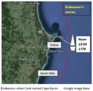
Replica of Endeavour in Byron Bay. EJW Photo – RTRL
EARLY EXPLORERS AND SETTLERS OF THE BYRON BAY AREA
Many other ships and crews sailed by Cape Byron in the years after Captain Cook’s passage in 1770 before any European landed at Byron Bay and investigated the area. These “passers-by” included Mathew Flinders in 1802 in the Investigator on the first circumnavigation of the Australian continent and Captain John Oxley, Surveyor General of NSW, in the Mermaid in 1823 on his survey of the NSW coast and Moreton Bay.
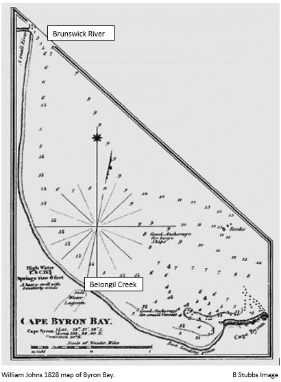
It was nearly 60 years after Cook’s passage before Captain Henry Rous, and William Johns in the Rainbow made the first landing in 1828. Rous and his crew collected depth soundings of the bay and went ashore to set up surveying markers. Johns prepared a map of the coast and bay between Cape Byron and “a small river to the north” (the Brunswick River). That map was the first to record the characteristics of Byron Bay. It shows a salt water lagoon (Belongil Creek), Julian Rocks and the best anchorage at the beach just west of “The Pass”. They identified the bay as providing safe anchorage for both large and small vessels.
Although convicts are known to have escaped to the area as early as the 1820’s surveyor Robert Dixon’s visit to Cape Byron in June 1840 on his horseback traverse along the coast from Moreton Bay to the Richmond River was the first documented visit by land. He recorded a tribe of fine-looking, Aboriginal men fishing with nets. He cleared vegetation off a peak on Cape Byron and established a trig station there as a base for future surveying and recorded the Letitia anchored under Cape Byron on its way to the Tweed River in search of cedar.
There were still no signs of European habitation at or near Cape Byron in 1865 when the NSW Inspector of Police visited. Rugged terrain, deep rivers and dense vegetation prevented easy access by land from any direction. It is recorded that the cedar-getters were at Byron Bay by 1869 and by the early 1870’s had set up tent camps at Byron Bay.
With the passing of the Crown Lands Alienation Act in 1861 the land in the Byron area was open for free selection by settlers. However, a reserve around Cape Byron, extending from Tallow Creek to Belongil Creek precluded selection along this part of the coast.
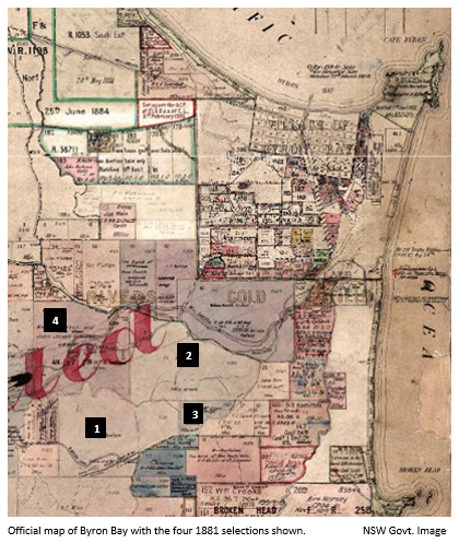
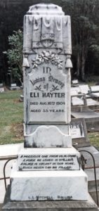
It was not until 1881 that the very first selection was made. Thomas Skelton selected portion 1 of 640 acres, Parish of Byron, on 2 June that year, followed by Joseph Wright, who selected portion 2 of 100 acres and Eli Hayter who selected portion 3 of 640 acres on 16 June. The final selection for that year was portion 4 of 604 acres on 7 July by James Glissan. These earliest selections were on the high land south-west of Cape Byron, well outside of the area that is now the town of Byron Bay.
The earliest dwelling recorded within the present Byron Bay area was a timber slab building in Palm Valley built by David Jarman and first noted in 1882. Being within the reserve this building was illegal. It was used as a hotel and a stopping place for people travelling north and south along the beach “highway”.
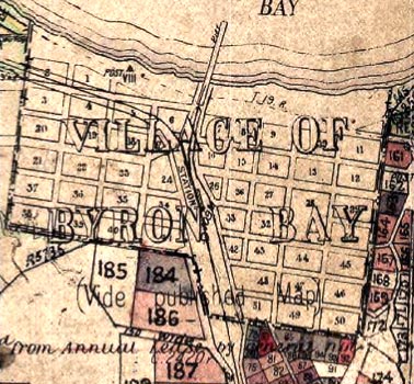
Plan of Byron Bay showing blocks, streets, old jetty, railway line and station. NSW Govt Map.
In 1884 the village of Cavvanba was laid out behind Main Beach, within the Reserve. The boundaries of the village and of the surrounding townlands were gazetted on 19 December 1885. All of the 40 town lots of half an acre each offered for sale in July 1886 were purchased including several by David Jarman. Cavvanba was proclaimed a village in 1890. However few of the lots were built on initially. It was not until the completion of the railway to the town in 1894 that a critical mass was reached and Cavvanba was renamed Byron Bay that year. It was declared a town on 28 August 1896.
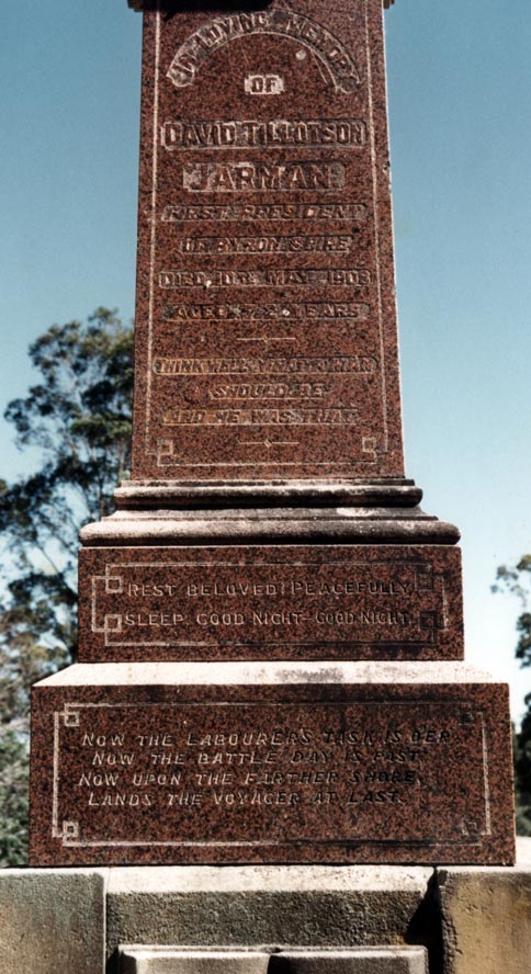
Tombstones on graves of settlers and pioneers, David Jarman and Eli Hayter. EJW Photo – RTRL.
THE CEDAR-GETTERS:
Up until the 1860’s the Byron area was covered by sub-tropical forest, part of the “Big Scrub” which covered much of the Northern Rivers area. These diverse forests, developed over the 25,000 years from the end of the last ice age, contained huge trees, vines and bushes.
The first cedar-getters arrived in the area in the late 1850’s lured by the potential for quick wealth. By the mid to late 1860’s there were many felling trees and exporting logs. They and their aboriginal scouts sought the large, straight-trunked, cedars that yielded valuable, beautiful, hard, red, termite-resistant wood. To fell these they stood on springboards notched into the trunk above the buttress roots to reach the clean straight trunk, which was sometimes up to two metres in diameter. Using axe and saw it took several hours of very hard work before the giant would crash to the ground. After cutting off the limbs they would brand the butt and with bullocks “snig” the log to the coast or to a stream or river bank where it would be rafted to the coast. In dry times logs would be left for the seasonal floods to wash them to the river mouth. In steep areas and areas with cliffs the logs would be slid or rolled, sometimes end over end, down “shoots” to the flat country below. This gave rise to place names such as Coopers Shoot, Skinners Shoot and McLeod Shoot. “Cedar-pirates” often claimed stock-piled logs leaving the contract cedar-getters with nothing for their effort. The challenge for the cedar-getters was getting their logs onto ships and transported to markets. They had two options; load them on ships in the Brunswick River at high risk or load them from the beaches through the surf at high cost. The Brunswick River was a small, shallow river with a treacherous bar. The ships wrecked and cargos lost were many. So most logs on the Byron area would be “surf-loaded”. When the sea was calmer bullock teams pulled the logs out across the beach, and through the surf either side of Cape Byron near “The Pass” or at “Cosy Corner”. The logs would then be rowed or winched to a ship anchored close to the beach, loaded aboard and transported to the timber markets of Australia and the world. From 1888 logs were hauled on wagons along tracks to be loaded on to ships moored at the “old jetty”. The first sawmill in Byron Bay was built in in Jonson Street south of the railway station precinct in 1891-92 to convert logs into more valuable timber. Sawn timber exports across the “old jetty” peaked in 1898-1900 with about 5000 cubic metres being shipped each year. By 1908 the export of logs had ceased and only the highest value sawn hardwood was exported. Timber exports became insignificant after WW1.
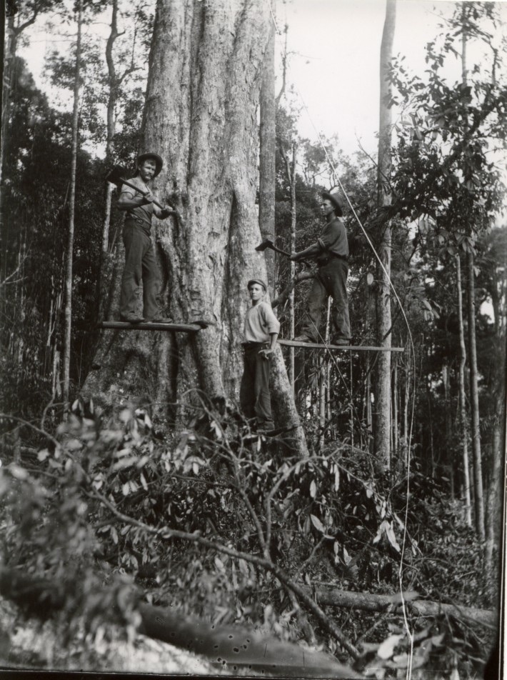
Wood cutters . EJW . RTRL
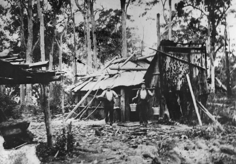
The first cedar-getter’s tent camps in the Byron area are recorded in the late 1860’s. Many later became farmers. Picture-010_WEBRES
The first cedar-getter’s tent camps in the Byron area are recorded in the late 1860’s. Many later became farmers.
Concerns about the impacts of the cedar-getters on the forests and eco-systems of the “Big Scrub” lead to the formation of the first state forests in 1910. These were expanded and became National Parks in 1982. Many Nature Reserves and two State Conservation Areas have been declared in the Byron Shire since 1982.
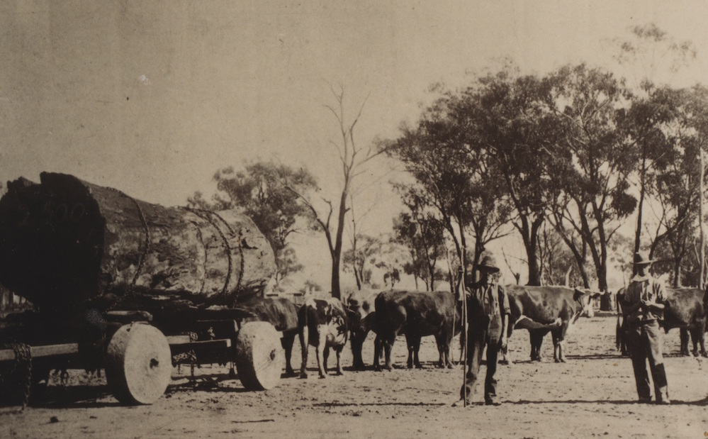
Primitive cart hauling logs to Byron Bay 1900 . (Source EJW – RTRL )
Less well known is the impact of the cedar-getters on the local Aboriginal people. As the first Europeans to make significant contact with the Arakwal Aboriginal people, they introduced the European values, attitudes, diseases and technologies of their time into these communities. These affected the health, culture, structures, and traditions of the Aboriginal people and set the seeds for the collapse of their population, loss of access to their country and use of its resources as well as the subordination of their culture.
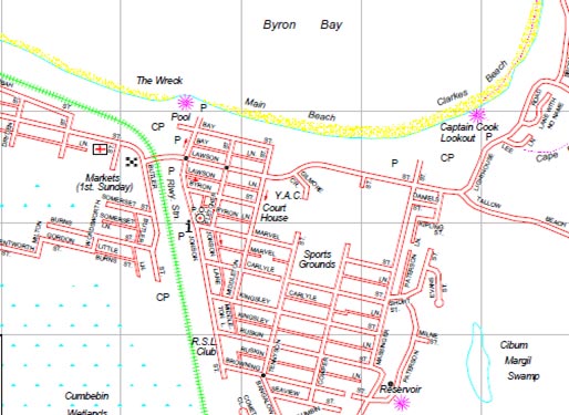
STREET NAMES OF BYRON BAY.
Captain Cook named Cape Byron in 1770 after Vice – Admiral John Byron (1723-1786) of the British Navy who circumnavigated the world in HMS Dolphin between 1764 and 1766. In time the bay that the cape protects became known as Byron Bay. The town, originally known as Cavvanbah ,after the local Indigenous name for the area, was officially named Byron Bay in 1894. Cavvanbah means “meeting place” in the language of the Arakwal people.
Surveyor Fred Poate designed and laid out the town plan for Cavvanbah in 1884. Either he or some Lands Department employee mistakenly believed that it was the famous English poet Lord George Gordon Byron (1788 – 1824) grandson of Vice Admiral John Byron that Captain Cook was honouring. That would have been rather prescient of Cook considering that George Byron was not born until 18 years after Cook’s voyage past the Cape and did not become famous until more 20 years after his birth.
Byron Bay Street Names WEBRES
From that mistaken belief many of Byron’s streets were given the names of famous English poets or literary figures such as Wordsworth, Browning, Milton, Marvel, Jonson, Kingsley, Carlyle Tennyson, Keats, Cowper and yes Byron. Some streets are more prosaically named such as Bay and Seaview. Cavvanbah Street provides a link to the original town name and the area’s Aboriginal name.
Lawson Street (originally part of Shirley Street) and Paterson Street provide an Australian flavour to the town’s street names honouring Australian poets Henry Lawson (1867 – 1922) and Banjo Paterson (1864-1941).
Juan and Julia Rocks, the original names given to Julian Rocks lying just off shore from the town, reflect the two main characters in Lord Byron’s epic poem Don Juan written between 1819 and 1824.
It is more than a little ironic that the streets of Byron Bay, a very industrial – seaport town until the 1970’s were named after men who were far from working class.
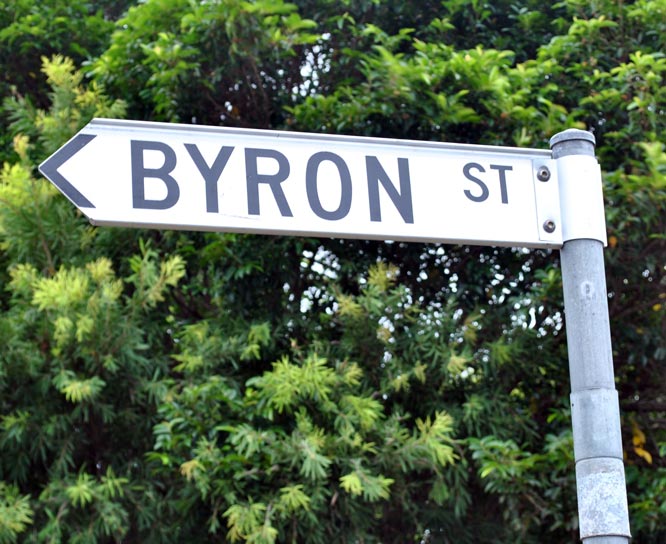
Byron Street . WEBRES